MDOT 2018 construction map now available for download
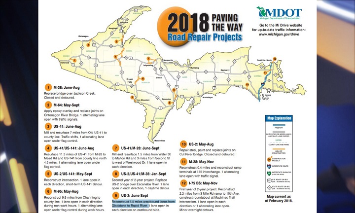
MICHIGAN — The Michigan Department of Transportation has posted the 2018 Paving the Way state construction map online.
The map is available HERE and will be on display at all rest areas and Welcome Centers across the state in the coming weeks. The public is also encouraged to download the map and print it at home or at their nearest library or print service provider.
Several of the high-impact projects featured on the map include the two-year US-2 bridge replacement project in Escanaba, scheduled construction of US-41, M-28 and M-95 across the Upper Peninsula, the I-696 reconstruction and resurfacing in Oakland and Macomb counties and other projects in the Lower Peninsula.
“The yearly construction map is an excellent snapshot showing the extensive work MDOT has planned for the year to improve the state’s roads and bridges,” said State Transportation Director Kirk T. Steudle in a press release from MDOT. “It’s also a useful tool to help drivers prepare for work zones along their planned route. Please remember to slow down in construction zones and avoid all distractions. The workers you’re trusting to fix the roads are trusting you with their lives. Drive safely and responsibly in their work area. We want everyone to make it home each and every night.”
The most up-to-date construction information for state roads is always available on the MI Drive traffic website (click HERE to access).